My Berlin and Brandenburg google maps
Google's change to the new google maps caused me some hassle, but finally I decided to take this opportunity to re-organize my maps (May 2014). Here is the result for the Berlin and Brandenburg area.
I started to work with these maps in 2008, as a plot for a Berlin-Brandenburg bicycle trip. Since then, and by now (2014), they have grown into a continuing collection of sites of both touristic, personal, historical, or any further character. Thus, these maps are no more a plot, but rather a starting point for planning any future trip on bicycles - or other means of locomotion.
I strongly recommend not to follow my bike tracks strictly. They would take you through sandy roads, cobble stone roads, forest tracks or even pathless mountains. - Speed is not my preference, nor is sport.
I have recently started to set - not yet really systematically - appropriate individual icons.
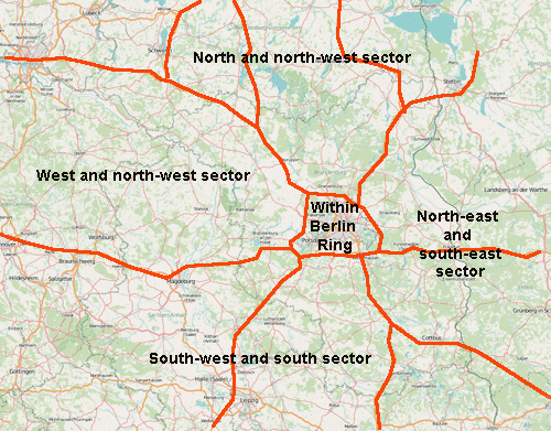
The "sectors" in this map are bounded by the highways to and around Berlin. Clicking into a highlighted area, a new browser tab will open and display the selected google map in full size. You cannot process the map unless I have granted you the right to do so. But you can bookmark them, or copy them into your own map.